

Barcode
How to create a city´s first skyline?
TYPE OF PROJECT: Masterplan
LOCATION: Bjørvika, Oslo
CLIENT: OSU (Oslo S Utvikling AS)
COLLABORATORS: MVRDV and Dark Arkitekter
SIZE: 300 000 m2
TIMEFRAME: 2003-2016
STATUS FOR PROJECT: Completed
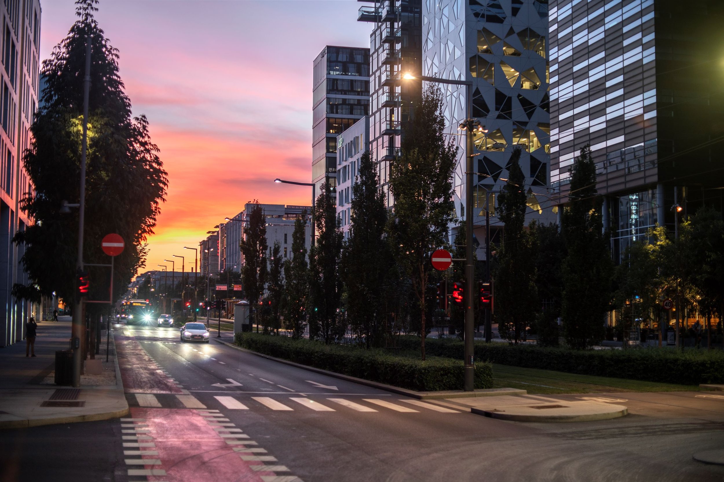
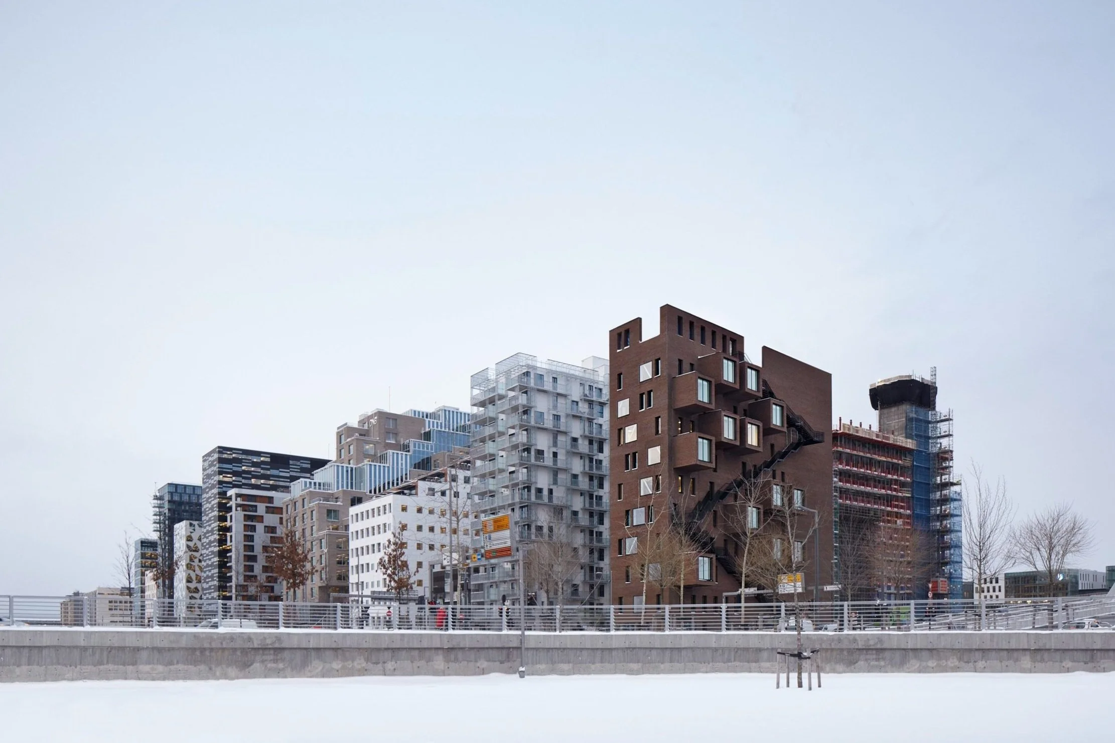
When The Wedge, the conclusion of the Barcode row, was completed in 2017, it was instantly applauded. Aerial photos revealed how the high-rises drew lines resembling an electronic barcode. Each building was different from the next — as a vibration of modern architecture. Its location in the heart of the harbor, where shapes and materials are reflected in the sea, made this high-rise row a symbol of a city in growth.
A-lab had the executive, coordinating role for Barcode's masterplan, in collaboration with Dutch MRDV and Norwegian Dark. With a plot area of 300 000 m2, this was the largest urban development project in Norway at the time. A new, innovative form of city planning, never before practiced in Norway, was developed - inspired by a Dutch, experimental style.

“Understanding what the Barcode development did to the capital of Oslo, requires knowledge of how the city was divided into an eastern and a western part. Bjørvika could be considered the interim period between two phases of the urban development of Oslo.”
Planning director of Hav Eiendom, Eivind Hartmann.
History
Hartmann has been working with Bjørvika for 20 years in The Agency for Planning and Building Services in the City of Oslo. He draws the historic lines to the fire that ravaged the capital in 1624. At that time, the residential buildings were centered on the eastside of the fjord, in what is now Gamlebyen. The wooden houses could not withstand the deceitful flames, and most of them burned to the ground. At the time, Norway was governed by Denmark, and King Christian IV followed his military council’s advice to build a new city on the west side, within the perimeter of the Akershus fortress, which was built under King Håkon V Magnusson in 1299. A renaissance style urban plan with brick buildings placed along a straight street grid – later named Kvadraturen – was in Gamlebyen’s place.
The city did not expand to the east and into Gamlebyen until the first railroad tracks out of Oslo were completed in 1854. As the railroad system and traffic grew, Oslo’s main railroad station Oslo Central Station built new tracks. On the south side of the tracks, a large freight terminal was built around World War 1. This lot was later the foundation for the development of Barcode, and is the historic basis for Norges Statsbaner NSB’s (now Bane Nor’s) ownership in real estate company Eiendomsselskapet Oslo S Utvikling (OSU), which is co-owned by Entra ASA and Linstow AS. OSU was established in 2001 to manage 380,000 m2 of the 900,000 m2 lot in Bjørvika.

Fjord development — A transportation issue
For several decades, the seafront was not accessible neither as a residential nor as a recreational area for Oslo’s citizens. I 1988, the city council decided to develop a plan for the transformation of the harbor area, and twelve years later, in 2002, Project Fjordbyen was passed.
At the time, Bjørvika was divided into harbor lots and NSB lots, and Oslo Central Station had large areas allocated to freight handling. The chosen site for the opera house bordered a gigantic interchange, Bispelokket, which tied a conglomerate of routes together. When the opera house was built in 2002, studies showed that 100,000 cars passed through this interchange daily. The success of the opera house accelerated the planning of an alternative E-road route through the city.
Several concept studies for a new road route were made, and the result was an engineering-wise highly advanced immersed tube. This project included a new main route through Bjørvika named Dronning Eufemias Gate, after Euphemia of Rügen, who was the queen of Norway from 1200 to 1312. The grounds under the street consisted of old seabed and filler, which meant it had to be built on piles resting on bedrock 50 meters below – in itself a costly project.

Barcode — Rules of creativity
When the transportation issue was settled, the Barcode lot was the easiest next step after the opera house. The 30,000 m2 large lot was on the south side of the railroad tracks and was not in conflict with the road network, current or planned. A-lab won the competition for the master plan for Barcode in the spring of 2003, in partnership with Dutch MRDV and Norwegian architects DARK.
The tree companies wanted to divide Barcode into parallel strips of land between two streets that would either be developed or remain open spaces. This design had historic parallels in Norway, for instance in the medieval buildings of Bryggen in Bergen.

“As opposed to regulating all the volumes within the planning zone in detail, which is commonplace in regulation work, we decided to lay out a set of overarching rules that would serve as the guiding principles for the design of each individual building. The purpose of these rules was to create a coherence in the buildings without governing the design of the individual buildings in detail.”
Project leader of Barcode and founding partner, Geir Haaversen.
If one building was tall, the one next to it should be lower. If one building had a bright façade, the next one should be darker etc. The rules were designed to give natural light, sightlines, building material variations, individuality and identity.
By setting up rules instead of regulating each building, nobody knew how Barcode would look until the last building was completed.


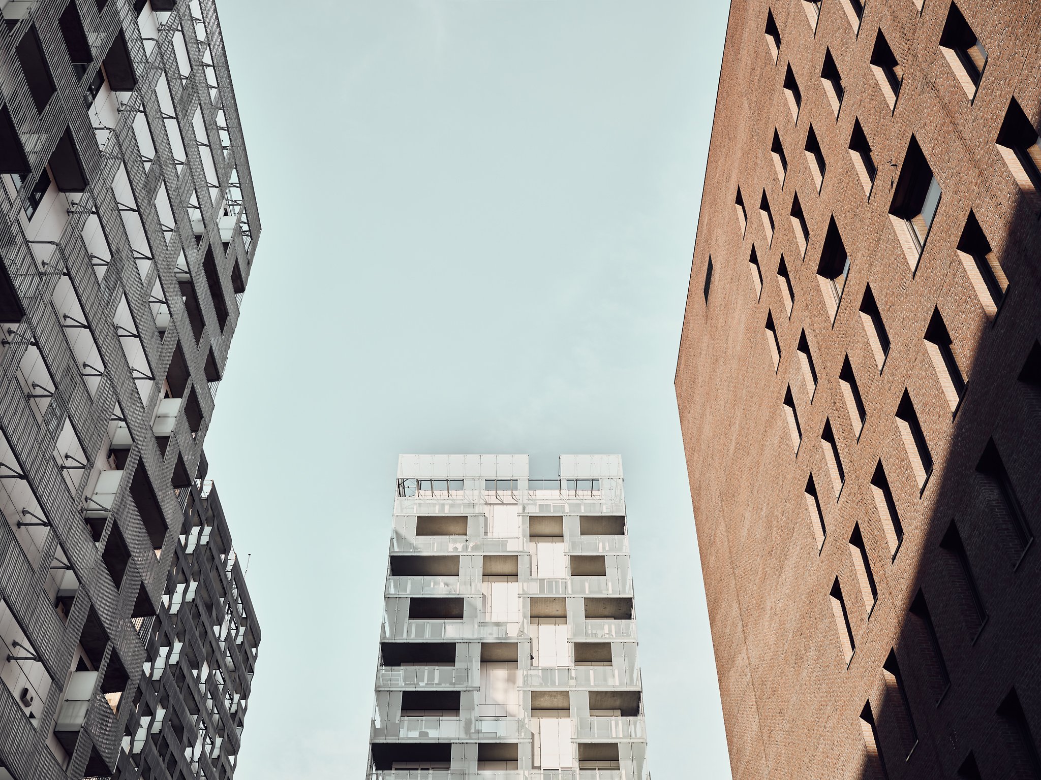
These rules were tried out in 64 variants of 1:1000 scale models. To show what these rules could produce, models of the building row were made. Rules means resistance, and executed properly, resistance is the best tool when designing architecture. Because of these rules, each architects’ office had to take the next buildings into account, while still striving for greatness. The result was buildings with a very sculptural quality.
As the senior coordinators of the master plan, it was natural for A-lab to design the first and the last building, as well as one of the buildings in between, to ensure the quality of the result. The first bar was the PricewaterhouseCoopers (PWC) building, which established a portal that serves as a gateway to the area and to this architectural domino effect.

“The local plan for the PWC building had a height limitation of 67 meters above sea level. This sparked no publicity, no debate. In the area around the railway station, high-rises as tall as 120 meters had been built. But during the regulation of the rest of the building row, there was much debate. Thousands of internet clicks against what was dubbed ‘The Bjørvika Wall’ between the city and the fjord made the city parliament members sway, and a coinciding election made this a poisonous cocktail.”
Planning director of Hav Eiendom Eivind Hartmann.
The result was one and a half years of political tug of war, before the city council, led by conservatives Høyre, got left wing party SV’s votes to approve the local plan. New requirements were made, for instance the buildings had to be modified to allow sightlines from the historic neighborhood of Grünerløkka to the green Ekebergåsen. Barcode was adopted with an area loss of 10,000 m2. The result was more space between the buildings, which in turn gave way for even more creative designs. Hartmann think Barcode probably benefitted from that.

From cathedral to …
As more and more buildings in the Barcode row popped up, each influenced by the design of the previous one, logos of international conglomerates started flickering on the facades, and it became obvious there was a new business district in Oslo. “There was a feeling of grandeur in being able to move into a building that looked like nothing else, that had a distinctive character,” Haaversen says.


The Carve
With the first building, A-lab set the standard, and the DNB building in the middle gave an opportunity to execute a clever architectural experiment in which to investigate the special architecture of cathedrals.
“The key is time. They would gladly spend 300 years building a cathedral. In architecture today, time is a limited supply. We asked ourselves whether we could, based on Norwegians’ frugal and sober attitude, design a façade of hand-drawn marble tiles. Two in-house architects spent two full-time equivalents completing the drawings.” Founding partner and CEO Geir Haaversen.
The Wedge
The final site was a narrow wedge between the building row and the main westbound route into Oslo and allowed no ponderings on cathedrals. Was it too narrow and ineffective to be worth developing? Barcode had become a business district for large corporations. What if this last plot could do the opposite and make a building that suit the undergrowth of smaller enterprises based around the city? Inspired by the classic brownstones with exterior steel staircases, it was decided to build Oslo’s take on a brownstone to conclude the Barcode row.
A cone-shaped building frame 11 stories tall gave floor plans that are between 5 and 10 meters wide. To save indoor space the meeting rooms were placed on the exterior, almost as if they had grown out of the wall. The famous New York style steel staircases function as emergency exits and balconies. Not only did these design measure free up space for the office areas, they also gave the building its iconic look.

Continual Growth, Bispevika
The 13 residential and office buildings in Barcode gave the Norwegian capital office spaces for 10,000 workers and 400 new homes in a new neighborhood with a distinctive character. On the street level, the buildings are connected via a transversal alley, and they will house 45 cafes, restaurants and stores, some facing Dronning Eufemias Gate. And that is not all. The Bjørvika development has continued to grow. A-lab was hired to draw the master plan for Bispevika, an area in growth directly in front of this popular skyline.