Details
Views:
162
Tags
Data Info
Author
DARK,MVRDV,A-LAB
City
Oslo
Country
Norway
Year
2016
Program
Business District
Technical Info
Site area
30000 sqm
Gfa
0
sqm
Density
0 far
Population density
0
inh/ha
Home Units:
0
Jobs
0
Streetsroad:
0
%
Buildup:
0
%
NonBuild-up:
0 %
Residential
0 %
Business
0
%
Commercial
0
%
Civic
0
%
Description
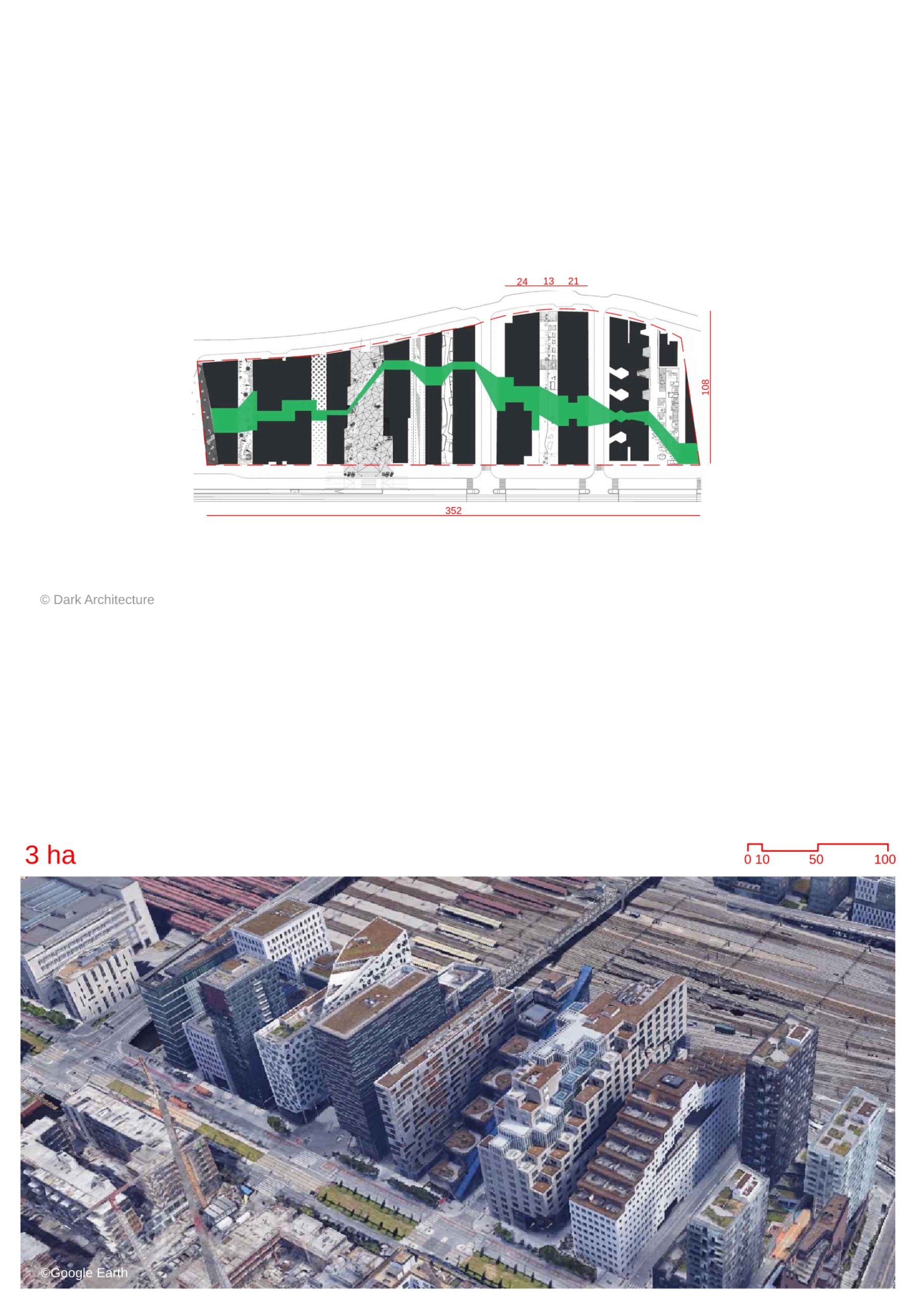
- The masterplan occupies a unique site in the city between the fjord and a major transport hub.
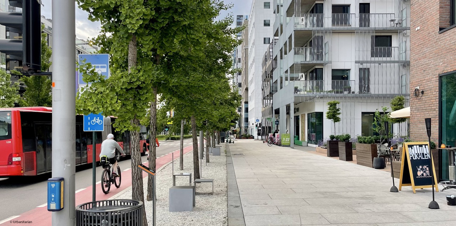
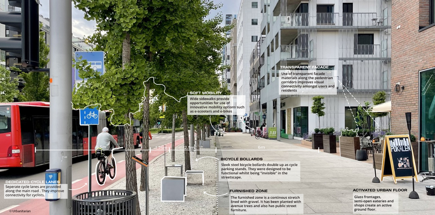
- The goal of the project was to maximize urban and architectural diversity, spatial flexibility, and create a pedestrian-friendly zone in the center of Oslo.
- The site is divided into narrow strips known as the 'Barcode', with each building having a façade facing the fjord and one facing the transport hub.
- The buildings provide maximum views and a higher number of addresses, accommodating housing, office, commercial, and cultural programs.
- The buildings have unique identities and material expressions while relating to neighboring buildings in shape and architecture.
- The masterplan includes urban rules such as differentiation in height and width of each building, minimum passage widths, and 50% green outdoor space on horizontal surfaces.
- All programs are present in all phases to create a balanced development from the beginning.
- The Barcode consists of 11 buildings designed by different architecture firms, following the urban rules.
- The ground level of each building is reserved for commercial and cultural facilities.
- The masterplan also includes underground parking, technical facilities, and a museum showcasing archaeological discoveries made during construction.
- The public space around the buildings is accessible 24/7 and serves as a lively pedestrian zone.
Interactive map
Streetscapes
Explore the streetscapes related to this project
|
Urbanscapes
Explore the urbanscapes related to this project
|
Sources
Explore more Masterplans
|


